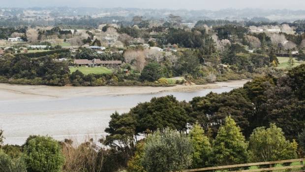
Intensification of a once-rural West Auckland suburb draws closer as notification of changes to land zoning is approved.
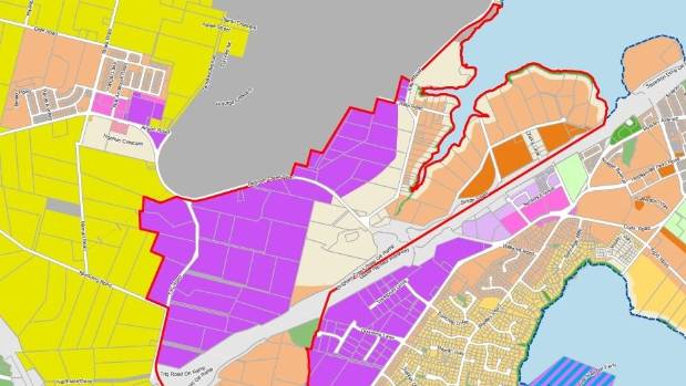
Auckland Council’s planning committee approved public notification of the rezoning of 360 hectares of land in Whenuapai for industrial and residential development on September 5.
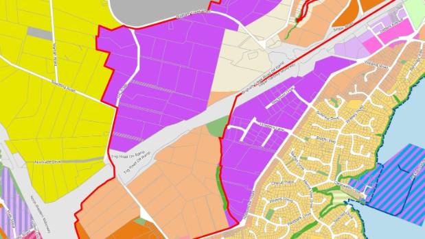
The first precinct to be rezoned stretches along the northern side of the Upper Harbour highway.
It includes part of Kauri and Brigham Creek roads, and the western end of Hobsonville Rd.
The area will allow for around 4000 houses, along with light industrial and business areas.
Light industry is scheduled for much of the area between Trig Rd and Brigham Creek Rd.
Residential zoning, including terrace housing and apartment buildings has now been applied at the western end of Hobsonville Rd.
There is also a new neighbourhood zone at the intersection of Hobsonville Rd and a re-aligned Trig Rd.
New noise modelling now means southern boundary of the Whenuapai Air Base is now zoned for light industry rather than residential as to protect aviation-related activities and residents alike.
Public notification of changes of zoning as set out in the Auckland Unitary Plan is the next step in urbanising the area, after approval of Whenuapai’s two-stage structure plan in September 2016.
In July, the Government also agreed to lend $300 million to Auckland Council to help accelerate the construction of homes.
This included a $10 million upgrade and realignment of Trig Rd, a bridge crossing State Highway 18 to the West Harbour Ferry terminal, and storm and wastewater improvements.
Sequenced development of the first stage of Whenuapai’s structure plan is scheduled to start between 2018-2022.